AVENZA Maps For CABLE ANALYSIS
- Tom Stilwell
- Dec 8, 2024
- 1 min read
Don't have access to GIS?.....No worries !!
This article will go through the steps of exporting lines from Avenza maps, to enable access to cable analysis tools. A basic knowledge of Avenza maps is assumed for this process.
Follow this link to learn more about the cable analysis options that are available.
Step 1: Select "Draw and measure" to draw in skyline corridors.

Step 2: Export layer from Avenza maps.
Select the "Layers" button in the bottom Right hand corner.

Step 3: The layers button will take you to this page, Its ok to just proceed as is, and leave everything as default.


Step 4: I Generally leave this next page as is and proceed with the export. If you are comfortable with Avenza you can manipulate these settings....Otherwise default is fine. Hit the Export button in the bottom Right hand corner.

Step 5: The previous "Export button" will send you to the page below where you can choose how you want to share the layer. Select your email and Send to thomas@schroderhill.co.nz
Or download to your phone and upload to this form

It's That Simple!!!!!
If you are sending layers via email include some specifications on your operations for example.
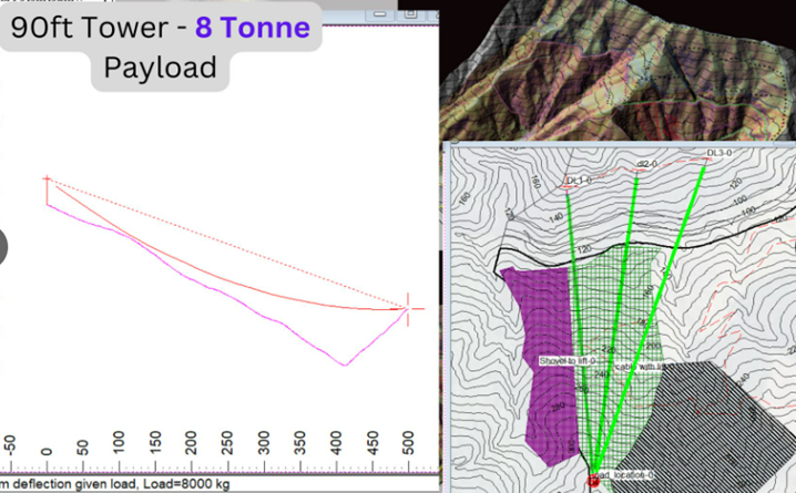
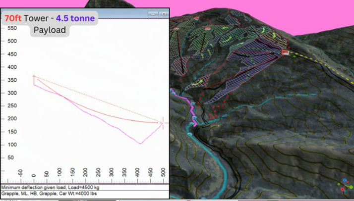
Tower Height
Skyline Size
Logging configuration


Comments